
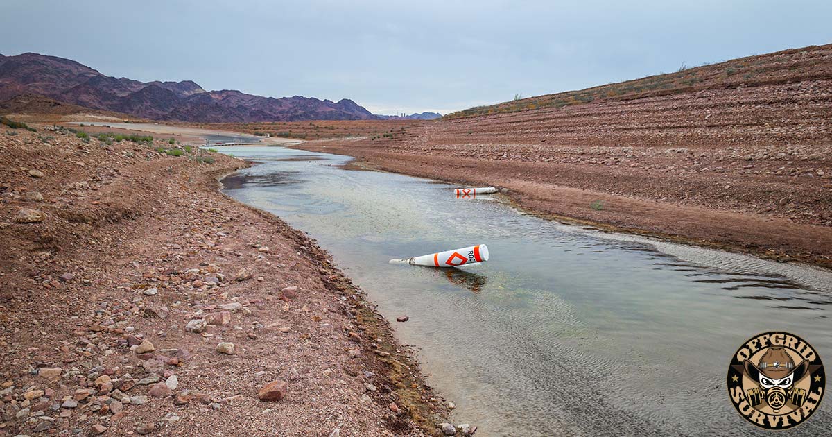
Every time you turn on the tap in Vegas, Phoenix, Tucson, San Diego, Denver, or a hundred other places out West, you’re pulling from a river that got handed out to more people than it can supply. That happened in 1922, and it’s been getting worse ever since. The whole thing was overpromised on day one. It just hasn’t fully broken yet.
I live in Vegas, near the bottom of the system. But this isn’t a Vegas problem or an Arizona problem. The Colorado River is one connected machine that runs from the snow up in Wyoming all the way down to a dry riverbed in Mexico where it used to hit the ocean. And right now every part of that machine is in trouble at the same time. The river, both reservoirs, the legal deal that splits it up, all of it.
Nobody in the prep world is really covering this, which drives me nuts. Everybody’s got a bug-out bag and a year of rice in the basement, but ask them where their water is actually from, how it gets to the faucet, and what breaks along the way, and you get a blank stare. So I’m doing a series on it. This is part one, and all I’m trying to do here is give you the full picture. We’ll take the pieces apart one at a time later, the dam issues, the lawsuits, the data centers draining the water…
Where the Water Actually Comes From
The Colorado runs about 1,450 miles. It starts as snowmelt way up in the Rockies in Colorado and Wyoming, picks up rivers like the Green and the San Juan and the Gila on the way down, and drains a chunk of land around 246,000 square miles across seven states before it crosses into Mexico. On a map it’s supposed to end in the Gulf of California down in the Mexican delta.
It doesn’t get there anymore. The river hasn’t reliably reached the ocean since the 1960s. The delta that used to be a green wetland is basically a salt flat now. We use up the entire river, drink it, farm it, evaporate it, before it can even reach its own mouth.
That’s the part people don’t get. This isn’t a river that comes up a little short in a bad year. We drain it to nothing at the finish line in a good year. There’s no slack anywhere in it. Every fight you’re about to read about is people arguing over a river that already runs dry before the end.
The 1922 Lie That’s About to Leave 40 Million People Fighting Over Water
The core problem is a math screwup from a hundred years ago that nobody’s ever had the guts to fix.
Back in 1922 the states split the river up with something called the Colorado River Compact. They divided it figuring the river carried something like 16.5 to 18 million acre-feet a year. (An acre-foot is roughly 326,000 gallons. Enough to cover a football field a foot deep, or run two or three houses for a year.) They cut everybody a share off that number: 7.5 million a year to the upper states, 7.5 million to the lower states, and later another 1.5 million to Mexico under a 1944 treaty.
Do the math and you’ve already given away almost 16.5 million acre-feet before a single sprinkler comes on.
Trouble is the river was never actually that big, not on a regular basis. The early 1920s just happened to be one of the wettest runs in centuries, so the entire deal got built on top of a wet-weather lie. The real modern average is down around 12 million acre-feet a year. And the stretch from 2000 to now is the driest 22-plus years the region’s seen in about 1,200 years. Researchers think the river could drop another 2 million acre-feet by mid-century as things keep heating up.
So you’ve got 16 to 18 units of water on paper coming out of a river that actually shows up with 12. That gap is the entire story. The low lakes, the dead hydropower, the lawsuits, the data center mess, all of it comes straight out of that one number that never added up.
The Colorado River Is Dying and Washington Already Knows It
To get the politics you’ve got to know the river’s split into two halves that basically don’t like each other.
The dividing line is a spot called Lees Ferry in northern Arizona, just south of Utah. Everything above it is the Upper Basin: Colorado, Utah, Wyoming, New Mexico. That’s the part where the water’s actually born. Denver even drinks off this river, hauling it east over the Continental Divide through tunnels to the Front Range. Salt Lake and Albuquerque lean on the system too.
Everything below the line is the Lower Basin: Arizona, Nevada, California. That’s where the big thirsty cities and the giant farms sit, out in the hottest, driest ground.
The catch that runs the whole war is this. Under the 1922 deal, the upper states are legally required to keep pushing a set amount of water past Lees Ferry down to the lower states every year, wet or dry, doesn’t matter. So when the river tanks, you get the nastiest possible question: does Colorado have to keep shipping water south to keep Phoenix and Imperial Valley wet while its own ranchers and little towns dry up? The Upper Basin says you can’t send water that doesn’t exist. The Lower Basin says a deal’s a deal, pay up. Now stretch that argument across seven states, thirty tribes, and Mexico, and you can see why nobody’s been able to close it out in court or at the table.
Both halves wrote up their own plans for after 2026. The plans don’t match. More on that in a minute.
The Two Big Buckets: Powell and Mead
In between the two basins is the actual plumbing, and it mostly comes down to two huge reservoirs sitting behind two huge dams. Lake Powell and Lake Mead together hold something like 80 percent of all the stored water in the whole system. When you hear the river’s “running out,” what that really means is these two buckets are going empty.
They work as a set, and which one’s which matters.
Lake Powell sits behind Glen Canyon Dam and it’s basically the upper states’ savings account, plus the spot where they hand water off. Snowmelt off the Rockies pools up there, and Powell lets water out downstream to cover that legal delivery and to spin Glen Canyon’s turbines on the way through. It’s the second-biggest reservoir in the country.
Lake Mead sits behind Hoover Dam, right by me outside Vegas, and it’s the lower states’ bathtub. Biggest reservoir in the country by size. Damn near everything Arizona, Nevada, California, and Mexico drink and irrigate with comes out of Mead, and Hoover makes power off it as the water leaves.
The chain is dead simple, and it’s the one thing to burn into your head about your own tap water: Powell fills Mead, and Mead fills your glass. If Powell can’t push enough water south, Mead quits refilling, and the lower states’ only real bank account starts draining with nothing coming in behind it.
Where both buckets sat as of mid-July 2026, off the Bureau of Reclamation trackers:
| Lake Powell / Glen Canyon | Lake Mead / Hoover | |
|---|---|---|
| Serves | Upper Basin storage + delivery | Lower Basin supply |
| Elevation now | ~3,524 ft | ~1,040 ft |
| Percent full | ~23.5% | ~one-third |
| Hydropower quits at | 3,490 ft (about 34 ft down) | ~950 ft (about 90 ft down) |
| Dead pool (no gravity flow) | 3,370 ft | 895 ft |
| Where it stands | lowest summer level ever | tied for its all-time low |
Put them together and the two biggest reservoirs in America are holding less water than at any point since 1956, back when Glen Canyon Dam wasn’t even finished and Powell hadn’t filled yet. We’ve got less water stored today than we did before they’d finished building the thing to store it in. Chew on that one.
Couple terms you’ll see in every headline, cut down so nobody plays you in either direction.
“Minimum power pool” is just the level where the water above a dam’s intakes gets too shallow to run the turbines without wrecking them, so they shut the generators off. At Powell that’s 3,490 feet, and we’re about 34 feet over it. At Hoover it’s around 950 after some retrofits, and Mead’s got more room there, closer to 90 feet. Powell’s the one right on the edge.
“Dead pool” is way lower. That’s the level where no water gets through the dam by gravity at all, where the river basically stops passing that point. Powell’s is 3,370, about 154 feet under today’s surface. Mead’s is 895, about 145 feet under.
And I’m not going to hype you, because plenty of sites will. Reclamation runs these lakes to the power line, not the dead-pool line. Actual dead pool only shows up in the ugliest, least-likely corner of their models. The thing water managers are actually sweating in the near term is losing hydropower. Dead pool’s the horror movie past that. So when you see a headline yelling that Powell hits dead pool by August, that’s the worst branch of a what-if tree, not a forecast. The truth’s bad enough on its own. Powell’s about 34 feet from the lights going out at Glen Canyon, and Mead’s already scraping the lowest it’s ever been.
Who’s Standing at the End of the Pipe
“Forty million people” is a number that just kind of slides off you, so let me put faces on it, because the users are all over the region, not just my end of it.
Up top in the Upper Basin you’ve got Denver and the Colorado Front Range pulling water back over the mountains, plus Salt Lake, Albuquerque, and all the ranches and farms out in western Colorado, Utah, Wyoming, New Mexico. These are the folks being told they might have to cut back so the water keeps heading south.
Down in the Lower Basin the numbers get scary. Southern Nevada, where I am, gets more than 90 percent of its drinking water out of Lake Mead. We were spooked enough about it that the water authority dropped around a billion dollars drilling a third intake, the “third straw,” that sucks off the very bottom of the lake at 860 feet, on purpose, so the Vegas taps keep running even if Mead drops below the other two intakes. They built that thing because the people in charge already know how bad this can get.
Arizona’s in the worst spot of anybody. The Central Arizona Project canal drags river water 336 miles uphill to Phoenix and Tucson, and under the priority pecking order Arizona’s dead last. Shortage hits, Arizona gets cut first and gets cut hardest. Federal proposals floating around would knock the Lower Basin down by up to 3 million acre-feet a year, and the roughest scenarios in the reporting have floated cuts adding up to as much as 77 percent of Arizona’s share. That’s not a typo.
Southern California’s big water wholesaler pulls close to a million acre-feet a year off the river for roughly 19 million people from LA down to San Diego.
Then the one everybody forgets, which is dinner. Something like 90 percent of the winter vegetables eaten in this country come off Colorado River water, grown in California’s Imperial and Coachella valleys and the Yuma area in Arizona. That lettuce, spinach, broccoli, carrots in your store in January got watered by this river. And it’s farms, not cities, doing the heavy drinking, around 70 to 80 percent of the whole river goes to agriculture. So the cuts aren’t about shorter showers in Scottsdale. They’re about the fields that feed the country all winter getting choked, which means higher prices at the store and more produce trucked in from places with looser rules.
Cross into Mexico and they get their 1.5 million acre-feet off the 1944 treaty, running Mexicali’s farms and cities. Cut that and a water problem turns into an international one real fast.
And the power. Hoover Dam alone keeps the lights on for about 1.3 million people, split roughly 19 percent Arizona, 23 percent Nevada, 58 percent California. Glen Canyon feeds cheap federal power to a few million more customers across the West, a lot of them rural co-ops and tribal utilities that count on it being cheap. Drop the lakes far enough and that power’s gone, and it goes before the drinking water does. Twelve of Hoover’s seventeen turbines weren’t even built to run in the low water we’re now flirting with.
Thirty tribal nations are on this river too, plenty of them holding senior rights on paper they’ve never been allowed to fully use. This isn’t some little regional slap-fight. It’s a big piece of the country’s water, food, and power all riding on one shrinking river.
The Clock Is About to Run Out
Everything up to here is the physical side. Sitting on top of it is a legal and political knot that’s honestly worse, because it decides who eats the cuts and when.
The rules for how Powell and Mead get run, the 2007 Interim Guidelines plus the 2019 drought plans, die at the end of 2026. They were written to last 20 years while everybody learned as they went, and that time’s up. The seven states were supposed to hammer out what comes next. They’ve been at it for years and keep blowing deadlines, a November 2025 one, then a February 2026 one, both gone.
In January 2026 Reclamation dropped a Draft Environmental Impact Statement with five different ways to run the river after 2026, everything from heavy federal control to friendly cooperative conservation to a do-nothing baseline. Comment period closed March 2. And Reclamation flat refused to pick a favorite, which was a message aimed straight at the states: work it out yourselves, or we’ll do it for you.
They didn’t work it out. By May 2026 Arizona, California, and Nevada gave up on the seven-state thing and filed their own Lower Basin proposal, cutting around the deadlocked group, promising 700,000 to a million acre-feet of extra conservation with the detailed plans due in August. The Upper Basin’s got its own take. Still no deal that everybody’s signed.
And the feds have basically said it out loud now. Interior’s moving to lock in the post-2026 rules by October 1, 2026, and if the states haven’t agreed, Reclamation writes the plan itself. Lawyers are openly talking about this ending up at the Supreme Court around the same time the new rules are supposed to kick in. And a few of the serious federal options would need Congress to actually pass something, which, good luck.
The timeline to keep in your head:
| When | What’s happening |
|---|---|
| Jan–Mar 2026 | Draft federal plan out, comment period closes |
| Summer 2026 | Final plan and the feds’ preferred pick expected |
| Oct 1, 2026 | Deadline to lock in the post-2026 rules |
| End of 2026 | 2007 rules and drought plans officially expire |
| Late 2026 on | New rules kick in, or it all goes to court |
Basically the ref is walking out onto the field, the players still can’t agree on the rules, and the whistle blows in a couple months. That’s the spot we’re in.
Okay, So What’s the Worst Case
Nobody likes saying it out loud, so I will. Real disasters aren’t one clean break. They’re a bunch of stuff going wrong at once, each thing making the next thing worse. Here’s roughly how the whole system craters:
A dry winter drops Powell under minimum power pool quicker than the models figured. Glen Canyon’s turbines shut down. A few million customers lose their cheapest, most dependable power right in the middle of a Southwest summer, when the grid’s already maxed out on air conditioning and a pile of new industrial demand.
Now the only way to move water through Glen Canyon Dam is a set of backup pipes that were never built to run full-time year-round. (That’s a whole story on its own, and it’s the next article.) If those pipes start eating themselves under constant use, they could have to throttle the releases while crews try to patch infrastructure that’s underwater and under pressure.
With Powell not sending a full load south, Mead quits refilling and keeps drawing down its own storage, heading toward Hoover’s power cliff around 950 feet and eventually its 895-foot dead pool. And there’s no backup reservoir behind Mead. Mead’s the bottom of the tub.
Meanwhile the seven states are in court instead of in agreement, so there’s no clean rulebook for who takes the cuts. Water gets handed out by emergency order and lawsuit instead of by plan, which is the worst possible way to run it.
In that world the cuts aren’t some tidy 10 or 20 percent worked out over years. They’re sudden, they’re litigated, and they land on the weakest users first: Arizona farmers, tribes with junior rights, rural power co-ops. Winter vegetable production out of Yuma and Imperial shrinks, produce prices jump all over the country. Cities slap on emergency restrictions. Mexico gets shorted and a treaty fight goes international. Property values in the fastest-growing metros in the country, Phoenix, Vegas, the Inland Empire, take a hit when the “unlimited desert growth” dream smacks into a hard physical wall. And tempers between farms and cities, upper states and lower, the US and Mexico, get ugly.
This isn’t me making stuff up. Reclamation itself, in an April 2026 statement, warned that the record-low snowpack plus record March heat were putting essential water and power infrastructure at elevated risk for more than 40 million people, and said action was needed right away. When the agency that literally runs the dams is talking like that, the prep crowd ought to be paying attention.
We’re not hitting dead pool tomorrow, to be clear. The states have been holding the lakes up by keeping water back, and Reclamation’s been parking hundreds of thousands of acre-feet in Powell that were supposed to flow to Mead, and draining smaller reservoirs like Flaming Gorge to stall. But that stalling should worry you more, not less, because it means the underlying math still doesn’t close and everybody involved knows it. All that effort is buying months. It isn’t fixing anything.
Now Here’s What Should Actually Piss You Off: Data Centers. In a Desert.
While all this is going on, while Arizona’s staring at a possible 77 percent cut and farmers are ripping crops out of the ground, we’re building some of the thirstiest buildings on the planet right in the middle of the drying desert. AI data centers. In the Sonoran Desert. On purpose.
The numbers are nuts. A Stanford investigation counted nearly 60 data centers already running in the Phoenix metro alone, sucking down about 177 million gallons of water a day and around 1.5 gigawatts of power. Maricopa County quietly turned into the second-biggest data center market in the whole country, behind only northern Virginia. And it’s speeding up. Grist reported the AI projects going up right now in Arizona could shove data-center water demand up 67 percent, to about 5 billion gallons a year, with cooling water in the Phoenix area maybe jumping 870 percent. One normal data center burns through roughly 300,000 gallons of water a day, about what a thousand homes use.
Now I’ll give it to you straight, because a lot of survival blogs won’t. Even at the worst buildout, data centers are still a small slice of Arizona’s total water next to agriculture, which drinks the lion’s share. Shut off every server farm in the state tomorrow and you would not save the Colorado River. That’s true, and anybody feeding you “data centers are draining the river” as the whole story is running a con.
But it should still make you mad, and it’s the right thing to be mad about, because it’s the timing and the priority that stink. We’re cutting the farmers who grow food and telling cities to ration, and in the same damn breath we’re hooking up brand-new water and power lines to windowless server sheds that hire almost nobody local. We pay a farmer to leave his field dry with one hand and pipe the “saved” water straight to a cooling tower with the other. Even Governor Katie Hobbs has started swinging back, floating a penny-a-gallon fee on data-center water and calling the industry’s tax breaks a $38 million corporate handout. Down in Tucson people killed a giant facility they nicknamed “Project Blue” under the flag “Not one drop for data centers.” The same officials calling the river “dire” one minute are green-lighting water-hog server barns the next.
That’s not a conspiracy theory, that’s just the contradiction sitting right in the middle of Southwest water policy. And the kicker is that Arizona’s literally been asking for more Colorado River water to run these things at the exact moment it’s facing the deepest cuts in its history. We’re draining a dying river to cool computers, out in a desert, and slapping “economic development” on it.
And Then There’s the Groundwater Grab
When the surface water gets tight, the next move’s always the same one people have made forever: start mining the old water deep underground and pipe it somewhere thirsty. It never ends well, and it’s kicking off right now.
In July 2026 the Bureau of Land Management signed off on letting Cadiz, Inc. turn an old buried natural-gas pipeline, part of a system that runs a couple hundred miles across the Mojave, into a water line. The plan, the Mojave Groundwater Bank, would pump groundwater out of the desert and sell it to buyers in Southern California and Arizona. Cadiz has been trying to pull this off for something like thirty years. Now it’s cleared to start building, on a 50-year grant, done in partnership with the Lytton Rancheria tribe.
The whole fight’s about the math, and it’s the same overdraft math killing the Colorado. Critics, including conservation groups and other tribes, say the plan would pump on the order of 50,000 acre-feet a year out of an aquifer that federal scientists figure only refills naturally at 2,000 to 10,000 acre-feet a year. That’s yanking it out up to 25 times faster than nature puts it back. BLM dodged the whole issue by calling the groundwater impacts outside the scope of their review and signing a “finding of no significant impact” instead of doing a real environmental study. Opponents say the pumping could dry up desert springs near Joshua Tree that keep wildlife and tribal sites alive.
You don’t need skin in the Mojave fight to catch the lesson. When the water you can see runs out, the powerful don’t tighten their belts. They go dig up the water you can’t see and drain that too, fast, with the paperwork greased. Groundwater pumped at 25 times the recharge rate isn’t a supply. It’s a countdown with a pipe on it.
It’s the Same We Already Told You With Water as a Weapon
A while back I wrote about water being used as a weapon, dams blown up in Ukraine, desal plants hit in the Gulf, hackers poking around US water utilities, the whole picture of how easy these systems are to break and how fast somebody can turn them on you.
The Colorado River is that same lesson in different clothes. Nobody has to blow up Hoover or Glen Canyon. We’re getting to the exact same place all on our own, through overpromising, drought, everybody in charge sitting on their hands, and a choice to dump what’s left into server farms and export pipelines. Whether your tap dies because some hacker hit a treatment plant or because a reservoir slid past a line on a chart, the guy at the end of the pipe has the exact same day: no water. Different cause, same math.
Which is the thing I keep saying. The stuff you lean on every day is way more fragile than the people running it will ever admit, the fixes move at government speed, and the real backup starts inside your own house.
What You Actually Do About It
You can’t refill Lake Mead. But there’s tens of millions of us living off this river, and you don’t have to be the guy standing at a dead faucet looking confused. This isn’t panic, it’s just backup on top of backup, same as everything else in prep. The deep how-to’s in the guides below, so here’s the short version of where to start.
Store real water, and a real amount of it. FEMA says one gallon per person per day, which is a joke in a hot desert. Go at least 1.5 gallons per person per day, two weeks minimum, a month if you can swing it. Food-grade containers, swap it out every 6 to 12 months. And don’t forget your water heater’s holding another 40 or 50 gallons you can drain in a pinch. Full walkthrough here: Long-Term Water Storage.
Get your own filtration, because city water can get shut off or fouled up quick, and a low warm reservoir grows its own nasty problems. A good gravity filter plus a backup portable one means you can make sketchy water drinkable. Start with The Best Portable Survival Water Filters and How to Purify Water Without Iodine Tablets.
Handle the power side too, because remember the hydropower dies before the water does. Lose Hoover and Glen Canyon generation, add a stressed grid, add record AC load, add the data centers, and you’ve got outages. Backup power belongs in this plan. Cheap starting point: Cheap Off-Grid Power: Real Solar Setups Under $1,000.
Think food and location. If a big chunk of the country’s winter vegetables comes off fields that might lose their water, then a garden, some stored food, and knowing how to feed yourself stop being cute little hobbies. See Long-Term Food Storage.
And stay plugged in. Watch Reclamation’s 24-Month Study, it comes out every month and tells you where Powell and Mead are headed before it ever hits the news. Sign up for your local water district’s alerts. And get your people together, because a real network shares supplies and info when it actually counts.
Where This Series Goes Next
So that’s where we area at. A river we’ve been sucking dry before it reaches the sea for sixty years. A founding deal that gave away water the river never had. Two halves that can’t agree on who takes the hit. Two reservoirs sitting lower than they’ve been since before the dams were even done. Rules that die at the end of this year, seven states that can’t agree, a federal government about to grab the wheel, and a handful of powerful players quietly hauling off what’s left for servers and pipelines while everybody else gets told to conserve.
You don’t get a vote on Lake Mead’s level. What you get to decide, today, is whether you’re the household that figures water will always just be there, or the one that already handled it before the delivery system hiccupped. One of those people has a rough week. The other one barely notices.
Next in The Colorado River Story I’m crawling down inside Glen Canyon Dam itself, the two “dead” lines, the backup pipes that are already showing wear, and the technical memo where the government’s own engineers admit the plumbing wasn’t built for the job we’re about to hand it. After that we get into the upper-states-versus-lower-states legal brawl, the data center fight, and what a federally imposed plan actually does to your state’s share.
Sources and Government Reports Worth Reading Yourself
- U.S. Bureau of Reclamation, Post-2026 Colorado River Operations: https://www.usbr.gov/ColoradoRiverBasin/post2026/index.html
- U.S. Bureau of Reclamation newsroom, post-2026 NEPA process and Oct. 1, 2026 timeline: https://www.usbr.gov/newsroom/news-release/5283
- Reclamation, 2026 operating conditions for Lake Powell and Lake Mead: https://www.usbr.gov/newsroom/news-release/5211
- Reclamation Post-2026 Alternatives Report (the five alternatives): https://www.usbr.gov/ColoradoRiverBasin/documents/post2026/alternatives/Post-2026_Alternatives_Report_20250117_508.pdf
- Live Lake Powell water data tracker: https://lakepowell.water-data.com/
- ABC News, water supplies along the Colorado River basin in peril (Powell + Mead + Hoover thresholds): https://abcnews.com/US/water-supplies-colorado-river-basin-peril-experts/story?id=133107551
- Circle of Blue, Hoover Dam approaches a hydropower cliff: https://www.circleofblue.org/2026/water-energy/hoover-dam-approaches-a-hydropower-cliff/
- Grist, Arizona water and data centers: https://grist.org/technology/arizona-water-data-centers-semiconducters/
- Maven’s Notebook, Lower Basin post-2026 proposal and next steps: https://mavensnotebook.com/2026/05/13/colorado-river-post-2026-operations-lower-basin-proposal-and-next-steps/
- Native News Online, BLM approval of the Cadiz Mojave pipeline: https://nativenewsonline.net/sovereignty/blm-approves-pipeline-conversion-for-mojave-groundwater-bank-project-developed-with-lytton-rancheria/
- Congressional Research Service, Management of the Colorado River (R45546): https://www.congress.gov/crs-product/R45546
Reservoir levels move constantly. Every lake number in this piece reflects mid-July 2026 Bureau of Reclamation data. Check the live USBR trackers for current figures before you rely on them.
Read the full article here